How to
Search
Find
How to
Join
Play Video
Video time control bar
0:00
▶️
⏸️
🔊
Audio volume control bar
0:00
/
0:00
↘️ 0.25
↘️ 0.5
↘️ 0.75
➡️ 1
↗️ 1.25
↗️ 1.5
↗️ 1.75
↗️ 2
↔️
↕️
Timecodes:
Related videos:
Flood Susceptibility Mapping using Google Earth Engine
Crop yield prediction with remote sensing data in Precision Agriculture in Google Earth Engine
How to Prepare Normalized Difference Water Index (NDWI) and Extract Water Bodies from NDWI
Flood Susceptibility Mapping using Google Earth Engine || Flood Hazard Mapping using GEE
Urban Heat Island (UHI) Map using Google Earth Engine and ArcMap Calculate Urban Heat Index and LST
Estimating biomass using Google Earth Engine
Introduction to Google Earth Engine (End-to-End Google Earth Engine)
Google Earth Engine 101: An Introduction for Complete Beginners
Machine Learning with Remote Sensing in Google Earth Engine for Beginners to Advanced GEE training
Flood Susceptibility Mapping using GIS-AHP Multi‐criteria Analysis part-1 || Thematic mapping
Google Earth Engine 7: Exporting Raster and Vector Data
LST, Urban Heat Island Effect, and UTFVI Analysis using Google Earth Engine and Landsat dataset
Chlorophyll-a Concentration Estimation on Google Earth Engine, and Export Images #GEE #Chlorophyll
Download Water body data (Shapefile) Lakes, River, Wetland of any Location
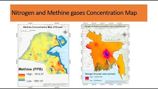
How to make air-quality Mapping using Remote sensing | Nitrogen and Methine gase Concentration Map
Landslide susceptibility in Nepal using Random Forest in Google Earth Engine (GEE)
Download NDWI in Google Earth Engine and Visualize image in ArcGIS
How to prepare Land Use/Land Cover Map and Calculate Area of LULC using ArcGIS Pro
Google Earth Engine 101 Part 1
How to use SPOT satellite imagery in Google Earth Engine | Download SPOT satellite imagery